
Jurisdiction-specific · Audit-ready
From outfall selection to audit-ready deliverable in one session.
Your engineers select the project area. TEN Hydrology ingests the data, applies your jurisdiction's own methodology, runs the analysis, and documents every step. No manual GIS setup. No tool switching mid-project.
How it works
Most H&H workflows take weeks before the analysis even starts.
TEN Hydrology compresses that to a single session. Select your project area, the platform ingests your data, applies your jurisdiction methodology, and produces a deliverable formatted to your reviewer's standard without a single manual GIS step.
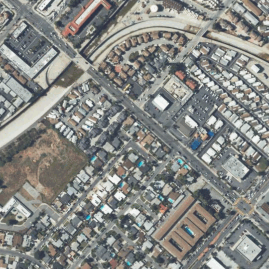
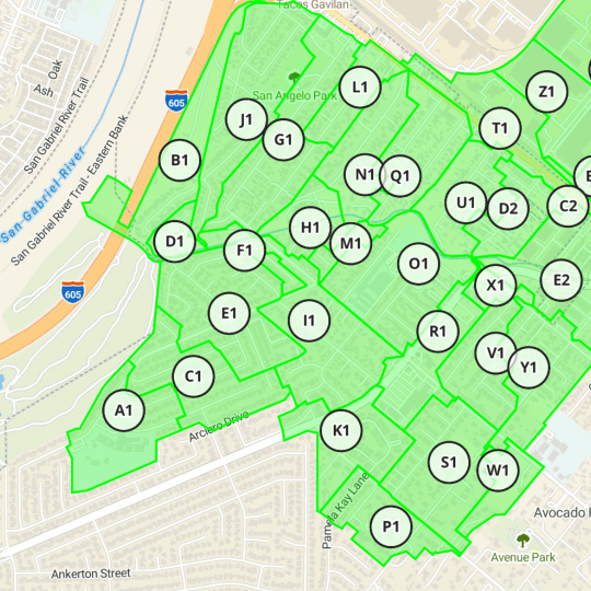
Select your project area.
Designate an outfall or draw a boundary on the GeoAI map. The platform reads your project location and sets the correct jurisdictional methodology before you touch a single input. Terrain, soils, land use, parcels, and rainfall records pool automatically.
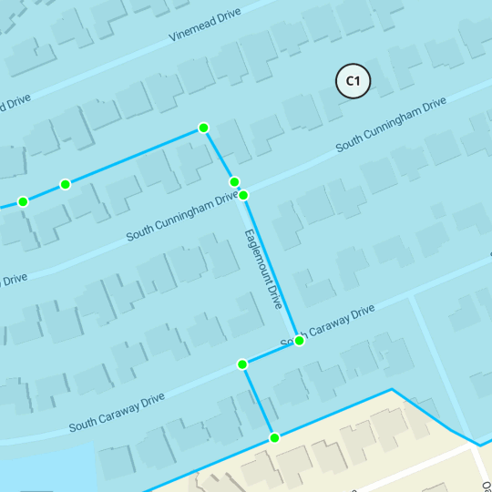
Control your inputs.
Review inferred delineations, imperviousness maps, and runoff coefficients through the vertical audit cross-section. Override any incorrect assumption through the chat interface or manual controls. Every override is logged and your engineer stays in control of the methodology.
Conduct your analysis and export.
Run HEC-RAS, EPA SWMM, and overland hydrology directly from the platform. Every execution is a named commit. Every input carries a dataset version, a timestamp, and a confidence score. Export to your preferred tool or deliver the audit package directly to your reviewer.
Export anywhere. Your tools. Your format. Zero rework.
TEN Hydrology exports directly to the platform your main team already uses. No reformatting, no version mismatch between what you modeled and what you submitted.


Limited deployment
Engineering firms in active H&H practice are first.
TEN is in limited deployment. Join the list and we reach out directly.